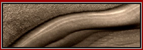
DUGWAY PROVING GROUND
Report #178
January 31, 2010
Joseph P. Skipper
Many large image files & slow download time on dial-up
J. P. Skipper can be contacted at: jskipper@marsanomalyresearch.com
The Dugway Proving Ground is a U.S. Army military
facility located about 85 miles (149km) southwest of Salt Lake City, Utah.
It covers a huge area of about 1,252+ square miles (3,243+ square km) or more
mostly in the Great Salt Lake Desert. Its official primary purpose as promoted
is to test biological and chemical weapon defense systems including radioactive
materials.
However, its huge size and remote isolation serves many more secret purposes
than that and its general area also serves as a site for US Air Force flight
tests. It has also been alleged to have housed recovered UFOs in the past
and UFO activity is very frequent in this area. It has been alleged that much
of the Area 51 secrets have been relocated to this area and that combined
with all the UFO activity has caused it to be referred to as Area 52 and it
has become infamous for that.
In November, 2009 what has been alleged to be a "meteor" (UFO?)
lighting up the night sky exploded in the atmosphere and scientists tracking
its trajectory determined that the pieces fell in the Dugway Proving Ground
area, so it got a little publicity as some wished to get access to the debris
area. Part of that publicity is that the area is not just closed to civilians,
even Army personnel are denied access to large areas because they are deemed
too dangerous.
Yes there are many secrets at Dugway due to its isolation. For example, on
9/8/2004 the NASA malfunctioning spacecraft Genesis in trouble was directed
to crash into this area. Note my Report
#164 paying special attention to the last 9th image on this subject. Likewise
the first Ultra-high-energy cosmic ray discovery was made at Dugway and it
is the home of considerable radio telemetry and tracking radar sites. So Dugway
is obviously no stranger to aerial and space related involvements. It is that
connection that has led me to investigate there.
One of Dugway's primary functions is still chemical and biological warfare
and it has a checkered past in this regard. For example, in March,1968 some
6,000+ sheep died in Skull Valley nearly 30 miles from the Dugway testing
sites and this coincided with several open-air tests of nerve agent VX at
Dugway forensically definitively connected to the sheep deaths and over US
Army denials. This demonstrates that both ruthlessness and carelessness are
alive and well where ever the human factor is found and things do not always
go well.
There are a great many interesting and strange things going on at Dugway but
this reporting only hits on some of the highlights that can be revealed in
surface satellite imaging and is not meant as a comprehensive examination,
so don't expect that here. Even so, this large report will contain 15 images
and all of them big ones with large file sizes, so do expect slow downloading
times.

The above 1st image is a distant context view
of the northeast part of the Dugway facility proper that also is the Michael
Air Force Base. This is the part of Dugway located about 80 miles southwest
of Salt Lake City and likely the portion referred to as Area 52 in some UFO
lore.
Note the two yellow arrows. The arrow on the left points to a site of bad
corruption on a side runway destroying it and examined in the 2nd image below.
The arrow on the right points to evidence depicted in the 3rd image below
that is just off of a highway that connects the base with the nearby town
of Dugway. The closer views below will reveal why this evidence is interesting.

The above 2nd image is a closer view of the damaged
side runway. As you can see, something went very wrong here and destroyed
this runway in a big way by cutting it into two sections. Note that the problem
is centered on and/or under the runway.
Since this to my eyes does not demonstrate a conventional technology blast
area (note no debris field to speak of or any blast patterns), it looks like
some new dimensional technology experiment gone wrong twisting the surface
deep down into the earth in some bizarre way. In fact, this may have originated
in some subterranean hidden facility or tunnel system deeper down and erupted
to the surface. Note also that it has been left alone and unrepaired up to
this point in time perhaps because it is still too dangerous to fool around
with.
While you're looking at this, please also note the great many light color
spots dotting the surrounding terrain. Other areas of Dugway Proving Ground
have this in evidence and especially where corruption of the surface areas
is suspected. The patterns are too uniform, evenly spaced and showing signs
of organization to be natural or the result material falling out of the sky.
Could these be small test drill holes sampling the ground for contamination
or judging its ability to handle future contamination?
I know one thing, with just this tentative surface look and considering Dugway's
past record and what it does, I wouldn't want to experience the above area
of runway damage first hand wearing anything less than full protection including
for radiation and I would still have to know a lot more details and think
several times before seriously considering doing it regardless of an top brass
assurances that it was safe.

The above 3rd image is of an large object just
off the main paved roadway leaving in and out of Michael Air Force Base. Note
the light color and apparent opaque transparency of this site. Although I
at first assumed it to be a surface coated parking area as most would, it
looks very much like some kind of flattened resinous dome material creating
an open rectangular cavity within. I've looked at it a number of times over
the last year or so during Google image updates thinking to catch something
on its surface but with no luck. It always looks the same as you see here.
Note how the vehicular traffic pathways within its boundaries are vaguely
seen and seem to be under and partially obscured by this material rather than
on top of it. If this is a flatten dome sort of like a thin hollow pillow
laying on the ground without massive supports inside to hold it up and designed
to let sunlight inside, then this is new dome making technology not being
shared with the public who paid for achieving it. Such self sealing constructs
would have many great applications in both civilian and business use as well
as the military use exhibited here.
Think about it, if it is a hollow sealed structure, just lay one of these
structures out on the ground surface and then cover it over with soil. The
structure is sealed and it disappears visually in the terrain and especially
with vegetation growing on top of it. It obviously can cover small or very
large areas. It would be impervious to the elements and storms. Depending
on the material's pressure strength, it may have underwater applications and
certainly the opaque semi-transparency material would essentially visually
disappear from sight underwater. Also, depending on the strength of the material,
it also may have armour applications.
If any of this is true, where did the material and the technology come from?
Did the technology come from aliens or is it just a another different application
of resins used to line and reinforce secret underground tunnel systems such
as those likely connecting Dulce, Area 51, Dugway and the Michael Air Force
Base?

Now take a look at the above two open pit mines
located still on Dugway Proving Grounds but much further west off in the desert
desolation and on the edge of some highlands. Note the blue color of the material
and the fact that both pits are located on the outer edge of down slope eroded
land forms. Note also that any mined material that was removed from here was
apparently taken directly somewhere else leaving little in the way of mine
spoil or tailings material behind. What ever this is, it appears to be mostly
useable as it is.
I'm pointing this out because of the similarity of color between this mine
material and the material of the possible dome in the 3rd image. Now salt
deposits may have this blue color in freshly dug material, so is salt a primary
ingredient here or is this just a salt mine mining especially pure deposit?
If so, why pass over great salt deposits between Dugway and this remote site
or closer north at the Great Salt Lake? Is there a special blend of chemical
constituency unique to this spot exposed by the adjacent highland slope erosion?
Or, is it that the salt deposit is just more available in a clandestine manner
out of the sight of prying eyes?

This 5th image adds some more information by
revealing this round platform site very near the blue stuff open pit mining
operation seen in the lower right corner of the image. Was the mined material
transported out of the area via aerial vehicles using this round platform
or is it for alien or experimental aircraft fuel use? Note that you can see
the beginnings of a unpaved aircraft runway running north northeast out of
this round platform. It is of sufficient length for heavy transport planes
but no more than that.
You should know that this mine site in on the edge of highland terrain. The
road you see above just above the mine pits to the right and east of this
site crosses a large stretch of flatlands desert. Roughly in the middle this
lonely flatland waste are what appear to be two of the rounded platforms under
pre-construction demonstrating what structures will be covered over by the
platforms. These two platforms were a part of my Report
#164. If you will go to that report now, you will see blue material as
part of those constructions likely used to harden and seal the sites.
Also in my Report
#155 I noted some finished round platforms in Nevada. I also noted in
that reporting that these are hardened round platforms including their extensions
capable of withstanding some fairly serious water erosion forces underneath
them. I am now putting forth the consideration that the hardening process
may not be accomplished by conventional building materials such as concrete,
etc. but by a higher resin technology we are seeing here in this report with
this blue stuff.
If you examine these sites in Google Earth using the coordinates given in
each image and follow the roads radiating out in various directions still
on the Dugway Proving Grounds and look closer, you'll again note the blue
color on the roads and when it comes to an end on them. I suspect that these
roads are toughened with this material using it as a type of pavement.

If you will remember, the main paved airstrip
on the US Army Dugway Proving Grounds is the Michael US Air Force base. North
of this point and about 30 miles north of Salt Lake City is the much larger
full fledged and staffed fighter attack Hill Air Force Base complete with
many earth covered bunkers. So the Michael Air Force Base at Dugway does not
serve this defense function and likely is primarily for experimental operations
and may also serve some other pilot training functions.
However, remember that the Michael base is Air Force and Dugway is Army. Dugway
Proving Ground covers vast territory and the largest air space. On the other
hand, off to the far northwest in lonely isolated terrain is a airstrip sitting
on the edge of a mountain and the flatland desert that looks older. On the
edge of this is the above round platform.
I cannot say what it is used for just as I can't for those in Report #164
and Report #155 or in this report. They most definitely are not Helo pads.
In any case, here is another one for your attention. Now with the next image
below, let's move a little closer back toward Michael Air Force base and Dugway
proper.

The above 7th image demonstrates a partial wide context scene of a much larger area of highland terrain. All of it has this same strange wavy pattern parallel ridges and gullies look. Sites of primary interest are pointed out with the yellow arrows. The blue arrows just point out how far the concentric rings extend out from the site to the lower left.

The above 8th image is a closer view of the site
on the right in the 7th image. The dark round area shows signs of some serious
likely chemical corruption. Note how the road bends around its edge on the
north side. Something has happened here and it isn't good. I don't think any
of us would want to take a stroll across this round area and expect to live
very long.
Remember my reference to November, 2009 publicity on the Dugway area as a
result of the "meteor." Remember that reference to parts of the
Dugway Proving Ground being denied even to Army personnel because they are
dangerous? Unless I miss my guess, this would be one of those places.

The above 9th image is a closer view of the site
on the lower left in the 7th image. As you can see this looks very much like
a round cage built on top of and in the middle of another one of these round
sites full of the same corruption as the site in the 8th image. However, in
this case, there seems to be a circular area around a cage fence looking facility
covered in what may be the blue stuff likely designed to insulate the center
area from the corruption outer area via this barrier material.
Now I have no idea what this site currently represents. Is it some kind of
tall cage to keep something confined within this corrupted ground? It's hard
to tell but there may be a shorter fence at the outer edge of the insulating
semi-translucent material. Is it now or was it at some point in the past a
mechanism or instrument of some kind with those increasing size outer concentric
rings or are they just remnants from a previous design/use of this site that
had to be abandon when the ground became too corrupted?
Truly Dugway Proving Ground lives up to its moniker as a proving ground where
experiments are conducted and some of them with dire consequences. It is indeed
a place of extremes and strange contrasts. There are others including here
at this general site area but we'll move on now to another site for something
else strange starting with the image series below.


The above 10th and 11th as well as the next 12th–15th images are of a distant site north of the area represented by the 7th, 8th and 9th images and northwest of the Dugway/Michael Air Force base. This huge rectangular object is located well out in the remote and lonely desert flatland and isolated there all by itself. Note the very geometric outrigger designs outside of the dark rectangle. These suggest that this place may serve a tracking telemetry purpose including into space. Could this include UFO tracking?

The above 12th image is a closer view of the
center of the dark rectangular area. What I most want to draw your attention
to here is the semi-translucent quality of the object even though it is dark
in coloration, the subtle but obvious side-to-side parallel ribbing pattern
in the material, and the fact that the subtle ribbing pattern appears to uniformly
curve downward nearing the right and left side edges.
This visual evidence indicates that this is a gigantic rectangular domed structure
elevated off of the ground like the military quonset huts of old (WWII) and
not the ground itself paved or unpaved. Note that the subtle ribbing pattern
is very similar to the semi-translucent material of the object in the 3rd
image as well as that surrounding the cage in the 9th image but without the
bluish color. This tends to support the speculation that the object in the
3rd image is in fact another of this material in a flattened rectangular dome
configuration.
The difference here other than sheer size is that this likely resin material
is darkened in color. That makes sense because if it wasn't, the natural semi-transparent
quality of the material would act as lens trapping strong sunlight and heat
inside tending to fry anything there. Further, without the darkening, adversaries
around the world looking at this object via their satellites with resolutions
far better than we can get here with Google Earth might be able to see too
much into the interior.

The above 13th image is a closer view of the
southeast corner of this huge structure complete with a small pond of water
on the right. Other than the semi-transparent quality of the structure material
with its obvious but subtle ribbing pattern looking an awful lot like liquid
resin technology, the main evidence here is pointed out with the yellow arrows
and labels.
Note that wheeled tracks exit through a hole in the structure side wall material,
traverse a short distance in the terrain, turn around, a go back into the
same hole they came out of. Note also how the tracks line up perfectly with
the hole and something inside seen through the semi-transparent material also
lines up perfectly with the exit/entry hole demonstrating the translucent
quality of the dark structure.
Another strange aspect of this structure material denoting it as resinous
is the fact that the exit/entry points show signs of being blown out raggedly
from the inside out by force rather than simply and precisely cut out. Is
this because someone did this just because they could or for a more revealing
reason?

We've looked at the southeast corner of the structure,
now the above 14th image offers a closer view of the northeast corner. From
this camera angle one can really tell a little more about the material ribbing
pattern shape as well as the blown out entry/exit ports in the material's
vertical end walls. Not only that, note that the narrow outrigger extension
accesses appear to also be enclosed with this resinous material creating a
sealed environment for them as well.
This latter factor makes sense because any telemetry devises/antennas present
here as outriggers can no doubt read through this semi-transparent resinous
material a lot better than through other substances. It is also likely why
this whole structure is not covered with earth to keep its presence a visual
secret. On the other hand, this immense facility is not likely devoted to
just telemetry data observation and gathering either. I suspect much more
goes on under this immense cover than that.

The above 15th and last image is a closer view
of the terrain just out from the northeast corner of the facility. As you
can see, it shows signs in the terrain of vehicle tracks going out of the
structure on repeated occasions, making U-turns, and then returning. Since
that is all that appears to have happened with these tracks, it's probably
reasonable to speculate that these may have been forays outside the structure
testing either the vehicles themselves or what ever they may have been transporting.
However, one shouldn't read too much into this evidence because the many areas
in the above scene that have a slightly rosy or sandy looking hue is smudge
image tampering applications. So there was something in this terrain that
someone did not want the public to see and you'll note that it is extensive.
Remember, what you can't see should be considered just as much as evidence
as what you can see. They've allowed us a look at this immense structure with
its outriggers because they likely anticipate that we're too stupid to figure
out much of anything about it. As I've said before, that arrogance is their
blindness and weakness.
Remember that what ever is hidden that is in this open terrain is hidden only
from those using Google Earth. If you are a foreign adversary or competitor
with your own satellites viewing this terrain, what ever is there is not hidden
from you. The net result is that USA adversaries and competitors know more
about what is here than USA citizens do. What does that say to you?
The thing that fascinates me most about this evidence is the blown outward
holes in the end side walls of this otherwise one piece seamless structure.
I have no doubt that these also serve as ventilation ports serving the length
of the structure as well as vehicle entry/exit ports. No such ports exist
along the parallel east or west sides of the structure. However, why not cut
them out with precision rather than blow out ragged holes? Further, the ragged
resinous material is apparently never trimmed?
Could it be that it is easier to focus and test a laser weapon from the interior
outward? Perhaps then vehicles pass through the opening mashing down still
soft blown outward resin into a ramp that then acts like pavement? Is that
the quick and dirty way to get it done? Always questions and few answers.
One thing is for sure, if these are structures created out of resin and able
to span great distances without much in the way of internal supports, that
is a highly useful technological advance. Further, if the resin is safe for
humans with respect to out gassing and the ingredients are commonly and cheaply
available as is the technology to apply it, then this is a technological breakthrough
that we can all benefit from here in the public. As such it needs to be shared
with the public rather than forever be limited to just a component for military
use.
This is a small brief surface look at some of the interesting things at the
Army's Dugway Proving Ground aka Michael Air Force Base aka Area 52. I suspect
that a great deal more of the most important stuff is underground. Further,
I suspect that what ever is underground is in turn tied in underground with
the Dulce facility previously reported on as well as other secrecy sites like
Area 51..
Joseph P. Skipper, Investigator
Contact
J. P. Skipper
Contact
the Webmaster