
MARS NORTH POLE BIO-ENGINEERING
Report #127
October 4, 2007
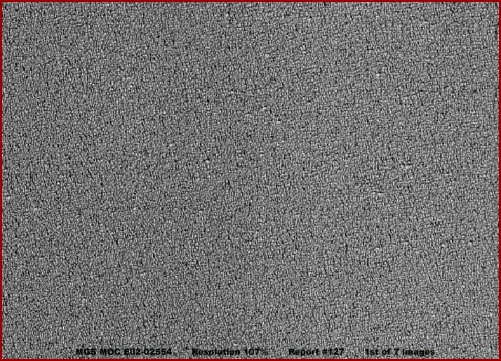
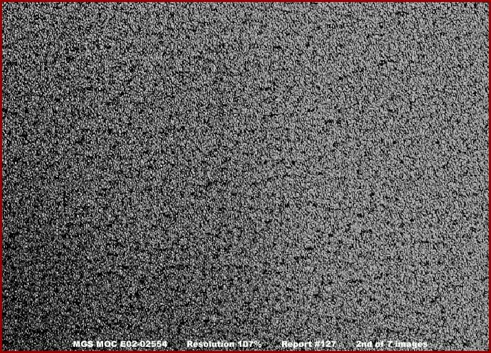
This report's 1-6 image evidence comes from a single MGS MOC E02-02554 narrow-angle image strip and the last 7th image from its companion E02-02555 wide-angle context strip. The above first image scene is located in the very top end of the narrow-angle strip and the second image scene is located in the strip's mid area. Neither of these evidence sample images as presented here have my usual graphic data frames around them because even with significant compression each is really huge in file size because of the great multitude of smaller size objects and texture patterns seen down there.
Both sampling scenes are from a long area in the upper and mid areas of the strip that are very bright and light reflective and constitute about 70% of the entire strip. This area is so much white washed out that just about all visible detail there is washed out in the official strip view. The detail of these sampled areas as represented by the above two black and white images had to be clarified from this washed out mess to see what is really going on there. Each represents a view from one side edge of the strip to the other side and the official statistics say that this distance is 3.28 km or 2.04 miles across.
As you can see, in either image, the only things that can be seen are many small insufficiently identified objects and their very uniform texture patterns repeated over and over again. Note that the first image texture pattern is smaller and finer than in the second image. This is the way the light reflective area evidence in the strip is. It gets progressively more and more coarse textured moving from the top of the strip down until it reaches a banded zone in lower part of the strip where it comes to an abrupt sudden stop.
As you can see in the second image if you will look close, the evidence with its many rounded nodules suggests that it may be super tightly packed vegetation life of some kind but the density is so great that this can't be sufficient determined. This evidence is in or around a dark notch that sticks deep into the North Polar Cap from its perimeter edge. Now I suspect it gets colder in the Mars North Polar Region than it does in the South Polar Region, so there is that factor to take into consideration here. On the other hand, I see plenty of evidence of biological life in the North Polar Region even if it is often different looking than in the South Polar Region, so there's that factor to consider as well.
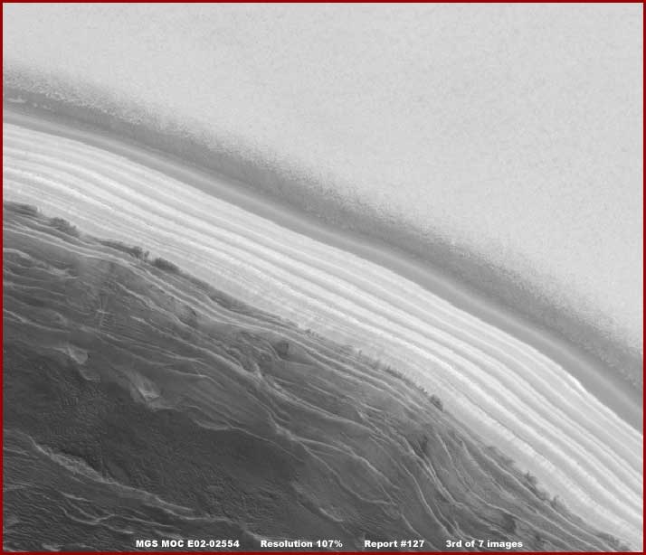
The above third image is vertically deeper than my normal imaging to adequately demonstrate where the visually white washed out terrain (constituting about 70% of the strip) encounters the banded area in the lower part of the strip consisting of a number of long bright reflective parallel bands. The above third image scene shows the parallel banded area from one side edge of the strip to the other just as it appears in the official view without any changes in it by me. As you can see, the terrain above the bands is very washed out with too much white color over saturation essentially destroying visual detail there.
The darker terrain in the lower part of the image represents rising elevation terrain in folds and terraces coming closer to the camera. Out of sight further below this point (not imaged here) is where the elevated terrain levels out and what looks like dark sand dunes occupy the entire bottom area of the strip.
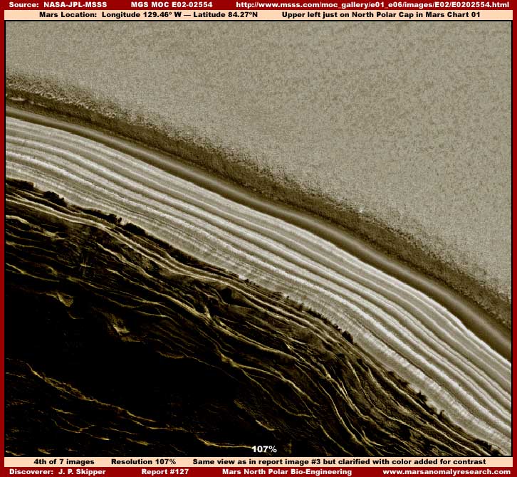
The above fourth image is just the third image clarified and with color added to bring out better detail in the banded and upper washed out areas. As you can see, the darkening of the washed out area in the upper part of the image to help bring out some additional detail there came at the expense of the already darker rising and coming closer to the camera terrain in the bottom of the image. Probably the most telling evidence in this image is the rougher texture (than in first & second images) but obvious still very level height of the evidence in the washed out area and how it piles up in a relatively tall vertical cliff wall where it encounters the first of the parallel bands.
As for those bands, note that the first upper band is strangely more light absorbing and darker as well as smoother appearing than all the other lower bands paralleling it. However, also note how there is a narrow diffuse light reflective surface gleam down the full entire length of this darker band that is always centered in the band's width. This full length reflectivity indicates that this long object is solid enough over its surface to reflect this solar light. Further, it is clearly a convex (curved outward) surface and smooth enough to reflect this solar light in this manner centered on the dome shaped surface.
If the more light reflective area in the upper areas of the strip is an ice field or geology, as some may argue, why is it piling up so vertical and cliff like and substantially so at the upper boundary edge of the darker band system? Remember this is a very distant view and that cliff wall system is very tall and obviously quite vertical. If it is solid particulate ice or geology, why have parts this vertical wall not broken off over time and fallen into or onto the darker band's space? If you will look close, the darker band is obviously completely free of any such overhanging debris and very clean.
Likewise and alternatively, if this is some kind of super tall super dense plant growth, why is it stopped dead in its tracks very sharply at the boundary of its mass with this darker band or tube system like hitting an invisible wall? If this is plant growth growing so aggressively as to being so tightly packed with no more available growth space, why would it not be showing some evidence of intruding at least partially and irregularly into the darker band space, at least to some extent as bio-life so often does in encounter physical barriers? This poor quality satellite imaging as released to us is frustrating in this regard. These questions demand a closer look to try and answer them.
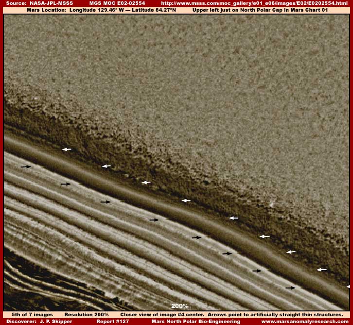
Sure enough as I examined closer the above fifth image with its 200% closer view begins to provide us with some possible answers to these questions. At the same time be aware that the closer view from an original very distant view does not treat the evidence mass above the darker band well because it is made up of smaller size collectively massed evidence that visually merges together rather than being seen as individually identified objects with space between and around them.
The only visuals that can be adequately trusted with regard to this great collective visually merging mass are the general overall rough surface texture patterns and the general cliff like wall in shadow and its demonstrated general overhanging height far above the dark band and thereby the height and depth of the great mass. This closer view simply cannot adequately answer the question of whether this great densely tangled mass is ice or geology or bio-life growth. In my opinion, the second image in this report does a better job of that as does the very level nature of the mass without a break in it.
On the other hand, the long continuous appearing darker band stands out better in this closer view simply because it is a single huge individual object large enough to partially overcome the the basic image resolution problems. One of the things this closer view provides, other than the vertical cliff like wall of the great mass hanging tall over the darker band, is some faintly seen lower rectangular platforms seen regularly space all along and just under the near edge of the darker band pointed out by the black arrows in the above image.
Further, if you will look very closely because they are only very faintly visible in this poor resolution, there is a straight linear line connecting from the right geometric corner of each of these low platforms at an angle to the opposite far side of the darker band as pointed out by the white arrows. This repetitive evidence is just distinct enough for its presence to be detectable and unquestionable.
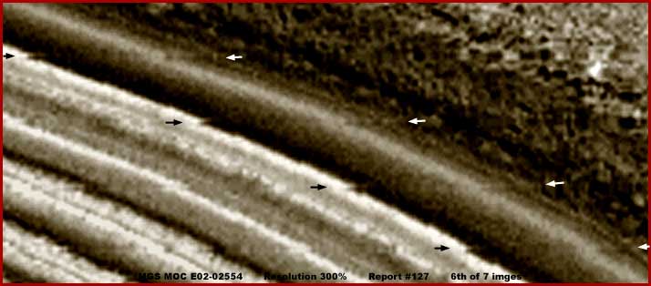
The above sixth image demonstrates an even closer but also poorer very grainy view of a section of the darker band. Even though the evidence is blurry and quite grainy, a few of the equally placed platforms under the darker band near edge are distinctly and clearly seen. Also, the very straight linear lines evidence connecting from the right edge of the geometric platforms under the near darker band side at a right angle across the darker band to its far side can also still be seen. In viewing this, it may help to position yourself alternating between near and further away from your computer screen as you view this.
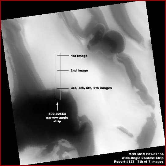
The above seventh image from the companion E02-02555 wide-angle strip provides some context into which the previous E02-025454 narrow-angle image evidence in this report can be placed. In basic, the darker color areas no doubt represent higher level terrain and the lighter color areas represent lower level terrain. Remember that all of the evidence here is well inside the perimeter edge of the North Polar Cap and in cold country even if not necessarily as freezing cold as the official position would have us believe.
So what is it that we have seen here in this reporting? At minimum, it appears to me that we are looking at advanced bioengineering at work here. Had the very different from the others darker band evidence and the great mass evidence hanging in a tall vertical wall over it been the only evidence, it would have been worth reporting for the questions that it raised. However, the addition of those regularly placed low geometric shape platforms under the near edge of the darker band with arrow straight linear lines crossing the dark band space to its opposite side put it over the top evidence wise for artificiality.
I think that we are looking at a relatively transparent many miles long massive artificial tube system with the solar light reflectivity gleaming off of its otherwise invisible to us surface in this poor resolution imaging. I suspect that there is an artificially constructed foundation under this as part of the system and that the elevated but low height massive platforms sticking out from under it at regular intervals along its length are part of it.
As for the arrow straight linear visible connecting lines extending from the near side platforms to the opposite side of the darker band, that just remains an unknown. I doubt it but perhaps the system was constructed in sections and the lines represent walls dividing the sections and is just too thin and too distantly seen to be recognizable? Maybe but I suspect more than that is going on here. This darker band, whatever it is, very obviously represents at minimum a barrier to the great collective mass the upper side of it. But, it isn't just a simple passive physical barrier like a wall. The key to understanding some of this is in what ever the great mass is?
If it is a North Polar Cap ice field, then the barrier may generate a heat radiation field keeping the ice field at bay, creating the overhanging cliff system, and also at the same time keeping the domed barrier itself clean as well as generating pooling water in base areas and thus the reason for the elevated platforms. In such a scenario, perhaps the darker band is also a tube system habitat and the flowing water generated as needed under the tube is used to create some kind of unique specialized crops represented by the additional lighter color too poorly seen parallel bands?
On the other hand, if the great mass is aggressive bio-life growth, the darker band system may be a tube that generates an electronic barrier. A barrier that may destroy and consume bio-life within a short range of it shielding and protecting the nearer lighter color parallel bands and explaining how the dark band system can be so free of debris? Yes the speculation list goes on handicapped by poor resolution imaging that doesn't supply enough answers.
However, the one thing that is abundantly clear is that the dark band and its poorly but still distinct enough seen foundation low profile regularly spaced platforms or block houses clearly represent very advanced sophisticated artificiality engineering on Mars and on an absolutely huge scale. I suspect that either way the bottom line is that the bands all represent a bioengineering process. It speaks of artificiality and very advanced technology as well as the will and resources necessary to accomplish massive projects on a truly colossal scale even on the Mars North Polar Cap itself.
It also says that we are here on Mars very much alive and plentiful as measured by the scale of our projects and you there on Earth should take us very seriously and not just regard us as a curiosity. In other words, it's a clue and a wake up call. Further, it is a message to those who would cluelessly float along thinking only about manned missions to Mars, old dead civilizations, and targeting acquiring territory and resources and getting the jump on Earth competitors here rather than thinking about establishing contact and insuring friendly relations there.
DOCUMENTATION
http://www.msss.com/moc_gallery/e01_e06/images/E02/E0202554.html: This link takes you to both the MGS MOC E02-02554 and E02-02555 official science data image strips that my 1-7 evidence images in this report were drawn from.
, Investigator
![]()