
CITY NORTH OF THE GREAT RIFT
Report #047
December 28, 2002
can be contacted at
This evidence site is in the northern hemisphere in the Thrasis region. It is in an area directly north of the west end of the great deep rift or chasma system on Mars. It is also triangulated between and below the heights of the Tholus summit/caldera nearby to the northeast and the Ascraeus Mons summit/caldera nearby to the northwest. This general region is characterized by past geological volcanic activity and the largest mount summits on Mars. This region is generally quite dry, probably because of the general height of the land relative to the deep depths of the west end of the great rift system directly south of this position that may have created a downhill underground gravity drain into the chasma over the eons. These two regions in such close proximity have the highest and lowest terrain levels respectively on Mars.
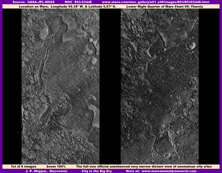
In the above first image from the E03-02448 strip, believe it or not, the depression appearing areas in each of the two sections of this strip as displayed contain evidence of a huge city metroplex. However, as you can see, it obviously doesn't look like that in the two above official 100% views and only looks like natural geology. That's because the total strip length is very long and very narrow and offers only this very distant view of the terrain. I suspect that this is entirely intentional because the city evidence you are going to see here is only a very small portion of an immense sprawling city system occupying this entire narrow-angle strip from top to bottom. However, extensive carpeting image tampering also present has successfully obscured most of this evidence with the lone exception of what you will see in the third image here. So once again, as with most of the civilization evidence on Mars, to report on this civilization evidence also means having to report on the image tampering as well. I get very tired of this but it is unavoidable.
Note again that the above views in this first image are the full 100% official size and contain no alterations or enhancements of any kind by me. When I see very distant views like this, I frequently look closer than usual. I've long since learned that a very distant poorer resolution view is sometimes by intent to drastically reduce resolution and obscure something probably already tiny in size on the surface where this kind of image tampering is most effective. That turned out to be the case here in this strip. The distancing is designed to obscure recognition of the presence of the extensive tampering which in turn obscures the real terrain evidence.
Note that in the above first image the strip scene section on the left is a lighter color down in the shallow depression areas with faint streaking where I've identified the city scene to be as opposed to the similar scene of the right of a different section a little further down the strip that is darker color with little or no streaking. That is because the scene on the left has been subjected to substantially more direct application object specific fog and blur image tampering also applied to create the streaking effect in addition to the distant resolution treatment.
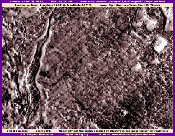
The above second image demonstrates this left section city scene at a closer zoom factor of 300%. Don't worry, if you don't see much of anything, you are seeing correctly. The fog and blur object specific treatment done at a much closer resolution than released to the public all over this scene has very effectively obscured almost all city structure detail. In fact, most researchers passing over this scene would not give it any thought as being anomalous and would quickly move on. I include this view here not to show you any real city detail but to show you what researchers like myself must contend with as the secrecy types very effectively manipulate our perceptions. I see immense numbers of these kind of blotted out scenes with this very effective image tampering all the time in the MOC imaging and must pass over them without reporting on it simply because I anticipate that inexperienced viewers and, in fact, most experienced scientists with prejudicial conditioned assumptions, will not be able to see what is really here either.
Before leaving the above image presented here only for comparison purposes, I will make one observation that is significant to understanding what is going on in this heavily tampered with scene. You should know that the file size of this scene is very large relative to the norm at just about double. This is a significant clue that, while we are not able to visually see the very high detail made up of a great many objects that is truly there, the graphics program isn't so easily fooled and does see both the real massive detail as well as the tampering overlay, which results in a huge file size. In other words, even though we can't visually see it, the software sees the many thousands of individual structures that no doubt are hidden under the tampering layer.
That it turn implies that the tampering is a layer of new information over and intermixed with the original information that it obfuscates as opposed to being a layer of new information overlaid over and digitally overwriting and replacing the original information that is then long gone. This makes sense because the original information and the later applied tampering information are mixed together in order to provide just enough distorted detail that obscures the image tampering itself from ready recognition. In such a scenario, despite layers being flattened and fixed, it is logical to consider that it may still be possible in some cases to electronically reverse engineer these kinds of images, separate the layers, and remove the top tampering layers from the original information. This would require a technical expertise quite beyond my skills but, if any of you out there have such expertise would be interested in taking a crack at this, feel free and let's work together on it.
![]()
The above image is the reason for this report and drawn from the darker color section scene to the right in the first image above. Here the tampering is still a serious factor, especially obscuring most all of the larger lighter color structures with direct applications while the smaller structures are mostly treated only with some blur/distortion treatment and with the direct fog application only on and between specific objects rather than the whole mass. This is why the general scene is darker than the left scene in the top image here because the many taller structures are throwing many shadows.
Even so, it still doesn't look very anomalous from a normal sitting position at your computer, so you will need to get your eyes down closer to the screen and look very closely and carefully. If you do that, you should be able to see more detail and that this is actually a jumble of thousands of vertically oriented geometric rectangular structures and, when viewed very carefully, actually bears no resemblance at all to natural geological ground surface detail. Also, you should know that the file size for this scene is over 2 times the norm meaning that the graphics program is again confirming the very high count individual hard object detail. If you will look close, you should be able to see that the meandering white lines on the left side of the image are actually lines of much larger structures that have received a covering treatment of both lighter color fog and blur tampering treatments along their length as well as base as the doubling technique down at pixel level that produces pixelization.
While still tiny and indistinct because of the extreme distance resolution tampering and all the other direct close-in object specific blur tampering, this is a very conventional city scene very similar to what one might see on Earth. I might add that some city high density areas seen so far on Mars are not often this conventional looking. The conventional and fairly familiar pattern of this cityscape is what persuaded me to present this to you rather than passing over it as I usually do as being something too tiny that viewers will not be able to identify. What you are seeing above is not lower profile suburb buildings but densely packed high rise rectangular structures of varying height. In other words, like a down town center of a huge city like New York here on Earth full of commercial very large high rise buildings.
By the way, this third image city scene is drawn from an area just a little below the second image scene in the official strip with a minor gap in between. You should be aware that either section presented here or both together only represent a very small portion of this immense wide metropolis that, not only occupies this whole strip, but its incredible size extends off beyond any of the strip's four sides. Even though we can see tiny artificial structures better here in the third image, that is more a function of the lesser tampering intrusion in it than due to larger and clearer building size. The fact that other structures in the second image here are more heavily obscured with tampering probably means that there were even larger buildings there that required a higher degree of tampering application density to obscure them. That is even more true with the rest of this strip with its effective super heavy tampering applications. So, the above third image we can see a little bit of probably does not represent the greater or greatest areas of this immense and sprawling city at all, just a gap in the heaviest tampering viewing a minor portion of this great metropolis probably with the gap existing only because the buildings were considered small enough to be taken care by the distance resolution tampering. Remember what this scene looks like in the official view as presented in the first image here.
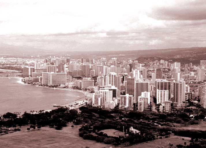
Now I know that most of you would prefer to see more conclusive city high rise buildings on Mars similar to the above fourth image view of an EARTH city. As you can see, everything in this Earth city scene is close, familiar, and certainly without ambiguity. However, you have to keep in mind that the above view is taken either from a low flying aircraft or from the top of a nearby tall ground structure. The view is only from a few hundred meters or feet distance in the foreground to a few thousands of meters or feet in the background or several kilometers or miles of distance in the far background. Further, it is taken from a pronounced low side angle view so that the sides of the building structures are very well profiled making the individual buildings appear as large as they really are as well as their window openings and floor levels stand out. That is what makes it so familiar and therefore so easy for us to identify and accept as the cityscape it is.
However, what one must keep reminding oneself is that, according to the official statistics, the distance from the satellite camera to ground level in this Mars E03-02448 evidence is 388.16 km or 241.19 miles with almost no slant angle. That means that we are mostly looking right down on top of the buildings and, no matter how big or massively tall a building may be, we are seeing mostly only their reflective tops as the most prominent feature and that also means their smallest visual footprint. What we're looking at is mostly only densely packed roof tops with only a very little of their sides and so the whole scene quickly and naturally merges into a indistinct jumbled mass where individual structures cannot be seen well even under good visual circumstances at such great distances. To make it worse, the scenes here in the E03-02448 evidence strip have, in my opinion, been subjected to severe manipulated reductions in resolution as well as direct object specific application of fog and blur image tampering and base doubling pixelization treatment, all done at a true resolution many times closer than that released to the public.
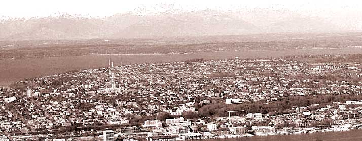
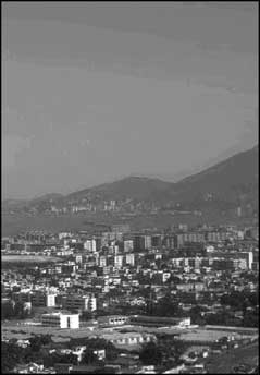
Meanwhile, the above fifth image is of another EARTH city scene. It is taken from a little more height but still at a relatively low slant angle. In the far background is a mountain range faintly seen with lower ground level vegetation and buildings covering the lowlands coming toward us and bordering on the far side of a river system in the background. This side of the river system is a sprawling city high density mass. Note that the tallest buildings are about 7-15 stories high with most much lower than this. However, even at this lower camera angle and much closer camera distance, roads or even faint road patterns are nearly impossible to see as are individual buildings except in the much closer foreground where some commercial buildings stand alone and are much taller than other structures in their immediate vicinity. Yet even though individual buildings are difficult to see in the mid and far background, we can still recognize the pattern of a Earth city in this scene even if we can't recognize individual buildings.
However, imagine what this same scene would look like from distant satellite imaging 241 miles away and then treated with resolution reduction treatments and plenty of fog and blur direct application treatments and base pixelization. Now add to that a claim that this was a view on Mars. The prevalent human psychology cultivated for decades that Mars is a frozen, dry as dust, dead world where such evidence must be considered impossible. Then take the closer foreground out of this scene, draw back a little further to create a distant view, and it could be confused with indistinct natural geology without any overt suggestion of being civilization evidence because that is what the viewer expects to see and therefore only what he or she allows themselves to see. The tampering techniques in the science data released to the public gets right behind this known psychology, dovetails in with it, and pushes it
I've included this slightly obscured and slightly vague small sixth image of an Earth city seen at a little more distance but still low camera angle. Note how the structures are already beginning to blend in and are starting to become a little indistinct and jumbled at this distance. If it wasn't for the lower camera angle showing full broad side views outlining the largest buildings so well, we would be in the a very similar situation as with the third image here in this report even with the closer view. Also, note the very indistinct densely packed building across a inland bay in the far background that are even more indistinct than even in the third Mars image here in this report. Yet, the E03-02448 image evidence is many many times this distance, the view is almost directly overhead with little to no angle, and also has to contend with obscuring treatments not present in this Earth city image. If this camera had taken this Earth picture from another 5 or 10 miles away, still much closer than in the Mars satellite imaging, this city scene would have been reduced in size and merged together, confused with geology, and not immediately recognized as a cityscape.
Further, claiming that this was a scene on Mars would have definitely profoundly impacted interpretations and conclusions via prejudice toward a natural geology scenario. Now add on top of that this information is not coming to you sourced from your established recognized leadership, which alone makes it suspect. This is the situation with civilization evidence on Mars. The natural human behavior and long manipulated expectation is that such evidence can't be there and therefore it isn't seen because it isn't possible and therefore no one is going to waste their time looking that close with an open mind. To over come this prejudiced observation conditioning, it would take evidence so obvious and powerful like that in the fourth image here of an Earth city close-up that can literally overpower the prejudiced conditioning. Of course, the secrecy types know this well, count on it, and the image tampering both at wholesale overall resolution level and down at object specific level, makes very sure that such obvious visual evidence is not going to be available in the science data released to us and all we are left with is the type of poor indistinct evidence that you see here from strip E03-02448.
Obviously, any one image of the quality that is available to us in the science data is alone never going to overcome this deeply ingrained and well manipulated and capitalized on prejudicial conditioning of the average person and that includes scientists. Further, these type of discoveries presented along and along one at a time are also easily ignored by this same prejudicial mindset. The only hope is that a growing collective body of work in its totality such as you find growing here at this website will eventually overwhelm by its sheer weight of numbers and eventually make some progress in raising awareness and perhaps at least in part defeat the prejudicial psychological conditioning that has been cultivated in us for so long.
Now, changing the subject back a little, take a look at the circular or oblong shaped object in the upper right corner of my third image. Note that it is surrounded by tall rectangular structures and the larger ones on the near side appear to be casting shadows into the interior of this circle, which interior has also been obscured with image tampering done down at a very tiny level at much closer resolutions never released to the public. You can fairly easily see that this circle is anomalous suggesting civilization evidence. However, if any of you get into the original science data strip who also have graphics software to zoom in, look very closely in the strip's lower half and you will see more of these circular artifacts of differing sizes that appear to be out in open relatively empty terrain.
However, this open terrain look is not real and is actually very heavy carpeting image tampering coatings that also create a fake streaking effect. These circular artifacts appearing in this apparent open terrain would on first glance be assumed to be craters but they are actually something else. If you have the software and look very closely at additional zoom factors, you will see that the edges of these circular artifacts have tiny rectangular structures around their edges similar to the one described here in the third image above. The interiors have also been doctored. As I have stated a number of times in other reports, the tampering software is programmed to cover everything up to but not including the top rim of what it is programmed to assume is a crater with the purpose of leaving a little detail in the overall foggy smudgy scene it has created to try and prevent bringing attention and therefore recognition to itself. In this case, leaving the "crater" rim alone results in a mistake and a small amount of tiny rectangular structures civilization evidence is left peaking out.
As a further test, suggest you image anywhere in this apparent blank open terrain where these circular objects are located and, if you are familiar with Mars imaging normal file sizes, you to will get unusually high file sizes confirming that the imaging software is seeing through the tampering coating and records the high evidence detail below it that the eye cannot see. This is especially evident to me, since I usually take the same size imaging for these reports from report to report and evidence site to evidence site and accordingly develop considerable familiarity with what is a normal imaging file size. Believe me, high file sizes equate directly to rough and therefore high terrain detail. True smooth terrain such as the eye sees here in this strip would equate to lower than normal files sizes. The fact that it does not and results in double higher size files is very telling evidence of what is really down there.
I could go on and on about this tampering business in this strip but I would have to demonstrate it with imaging and I've run of total image file size room in this report if I am to preserve halfway decent total report loading time and its got to be cut off somewhere. One of the main reasons for running out of room is the double size files for the second and third images here. There is also other civilization evidence in this strip but it is lesser than that in my third image here, so I'm just going to mention it and let it go.
The next report will also contain similar civilization city evidence but off of these volcanic heights and down in the great rift system itself. But, where the city evidence here in this report speaks of more familiar patterns we might be familiar with here on Earth, the next report located in a nearby region will show that there are some differences in civilization evidence architecture with implications of probable cultural, racial, and/or species differences. Look for it coming next.
ADDENDUM
As I present more of this type of distantly seen densely packed rectangular structure evidence as seen in tiny distant resolution, it has come to my attention that there have been a few detractors posing as knowledgeable in some chat forums claiming that I am blowing my images up too much and that I am mistakenly creating and/or outright fabricating evidence by creating rectangular objects in the process of blowing my images up too much introducing pixel influence in creating rectangular appearing structures. An example of this, I'm sure they would say, would be what you see in my third image in this report.
Pixels are of course also rectangular and in fact square. Obviously, by making this association, it gives detractors the opportunity to try labeling me a crackpot and attempt to marginalize this evidence. Unfortunately, I simply do not have the time needed to respond to these criticisms individually, so I'm going to respond to this in addendums to reports like this where this type of evidence is being presented. Basically this is just amateurs posing as knowledgeable carping and taking free potshots to look like they know what their talking about in these chat social settings but some could also be representing hidden agendas. It is significant that not one of these few have actually contacted me directly with such criticisms. Still the point raised should be responded to, just rest assured that such criticisms are not true and say more about the agendas and psychologies of these critical few rather than about any of the evidence itself.
When I initially review a image strip, I do like everyone else and do it at the official supplied 100% resolution in the science data. In this particular strip, what I saw is exactly what you see in the first image presented here. Most would admittedly see nothing. However, after viewing tens of thousands of strips, I now have a experienced eye for what I am looking for and I could see the faint extremely tiny organized city PATTERN in these lowland depression looking areas causing me to look very close and then I could see extremely tiny rectangular structures. Further, I was alert for this because of the extensive image tampering in this strip that I've come to learn always means civilization evidence and because the strip was very narrow, which also often means distance resolution tampering covering civilization evidence. In other words, the presence of the tampering had a good deal to do with my looking at this strip at the official resolution with a closer more critical eye. Even so, only once in a great while does this result in being able to find something sufficiently reportable because the tampering is very good and very thorough but once in while does make a mistake as it did here in leaving a small section out for us to look at.
I think that even these few critics will agree that rectangular shapes evidence initially seen at official 100% resolution imaging has no chance of being associated with individual pixels and that is where I start with my recognition. One of my tests of small to tiny rectangular shaped evidence is zooming in and out in continuous increments via a zoom slider bar (not large jumps) and watch how the suspected evidence resolves itself. In this continuous back and forth process, one can see how the evidence reacts to the pixel lines. If the evidence starts conforming to the pixel linear lines, then it is questionable and not reportable. However, if the evidence continues to develop not along associated pixel lines and remain independent of the pixels, then it is maintaining its integrity as ground level detail and evidence in spite of the pixelization trying to force it to conform to the individual pixel box lines.
You see pixels are not individually variable in size from one to another, rather they form a rigid grid pattern and all pixels are the same size throughout a scene as presented to us in the science data. If pixels are really a significant factor in the process of my enlargement of an evidence scene, then they will be a factor over the entire scene, not parts of it. If a would be detractor thinks he or she is seeing pixelization in only parts of one my evidence scenes, such on what I have identified as artificial rectangular structure ground level detail, then look around at the total scene. If you do not see (& you want in my evidence) this same pixelization in every part of the whole scene, then you are not looking a pixel distortion due to the scene being blown up by me too much simply because the pixel effect would be universal over the entire scene. One of the best ways to test this is to see if you can see this pixelization in the soft smudgy areas, which is usually the later object specific tampering application applied after the pixelization treatment. If the soft smudgy area is unaffected by the pixelization, your looking at direct object specific tampering applied later on top of the pixelization treatment and at a different manipulated resolution, once again revealing the existence of higher resolutions not made available to the public.
If you see what may appear as pixel distortion only in certain parts of the scene, especially at the linear edges of tall light color high reflectivity rectangular structures, what you are looking at is image tampering all right but down a pixel level done before the release of the imaging to the public and not by me. One technique is to blow up the scene to enlarge pixels and then slightly offset one identical scene on top of another. This is a pixel offset mismatch method of cutting resolution and creating a type of blur without using filters or direct surface applications. The evidence of this is especially prevalent and identifiable around very light color rectangular objects with one or more linear straight lines and/or right angles associated with them. Further, it can be applied a number of times as needed to increase the distortion effect. However, the straight linear lines and right angles of the rectangular objects are still there and are still true terrain detail, just blurred and/or doubled by the base official level tampering designed to obscure them.
The tampering process itself is further enabled by what should now be increasingly obvious that whoever is doing this is operating with resolutions far greater than that released as science data for science and public consumption. You have to approach this subject with logic and reason. In the 1970s military intelligence satellite resolution was good enough to pick out individual objects the size of human beings or at the very least something the size of a jeep. Since then there have been many leaks and indirect references and smug looks about being able to see objects down to the size of a vehicle license plate and even identify people. Does it stand to reason that any camera system less than this would be sent to Mars in a one shot deal for satellite imaging around that distant planet, especially if civilizations were suspected to be present?
Yet, the MGS MOC imaging resolution results as presented to us isn't even up to the 1960s satellite imaging of Earth standards, at least when it comes to what is being released to the public. The proof of this is in the third image in this report where very large high rise rectangular city structures a great many times larger than a jeep as seen through clear atmospheric conditions are so tiny and indistinct. Military intelligence simply has much better imaging technology than this at their disposal and you can bet that high level Navy Admiral coming from the top most echelons of military intelligence and chairing the JPL oversight committee in secret would have made sure such technology was on board the MGS vehicle and constituting the MOC imaging systems. It seems that the deal is, you pay for it but we keep the results secret from you. Does that sound reasonable to you?
Make no mistake about it, this level of prolonged secrecy slipping and sliding lasting for many decades in every aspect of space exploration is itself a direct measure of the role National Security plays in this whole science vs. Mars exploration thing. Logically, do you think that level of National Security and secrecy involvement as evidenced by the image tampering would be involved in the exploration of Mars because it may have a little water and some plants on it to hide? Likewise, do you think that level of National Security and secrecy involvement would be involved if even a few animals, birds, insects, etc. or even peoples at levels of development less than our own or some long dead civilizations were involved? Think about it. You intellectually know the inescapable answer to this as well as I do. The only question is whether you will accept it emotionally or not? That choice as always is of course yours.
If you are unable to accept this National Security secrecy role and/or find the evidence so far presented here at this website insufficiently compelling to follow such logic and reason, then be prepared for some future even more unsettling revelations along these same lines here. You will eventually be seeing much more compelling evidence of this secrecy agenda at work at this website as soon as I am inclined to present this information. At some point, even the close minded will be impacted.
DOCUMENTATION
In checking behind me to verify this evidence, the easiest source for the science data strip is to access it at the MSSS website link below. Just remember though that the official science data strip is very long and narrow offering only a very distant view as exampled in my first image at the top of this report. To see anything significant like the city evidence here, you will need graphics software to zoom in and enlarge the strip as well as sharpen up the view, which defeats a little of the direct tampering applications. All three of the browser compatible strips at MSSS work and have the same orientation.
MSSS ..... http://www.msss.com/moc_gallery/e01_e06/images/E03/E0302448.html
, Investigator
![]()