
DENSELY PACKED LIFE EVIDENCE
PART 2
Report #043
DOCUMENTATION: MOC M04-04070
August 30, 2002
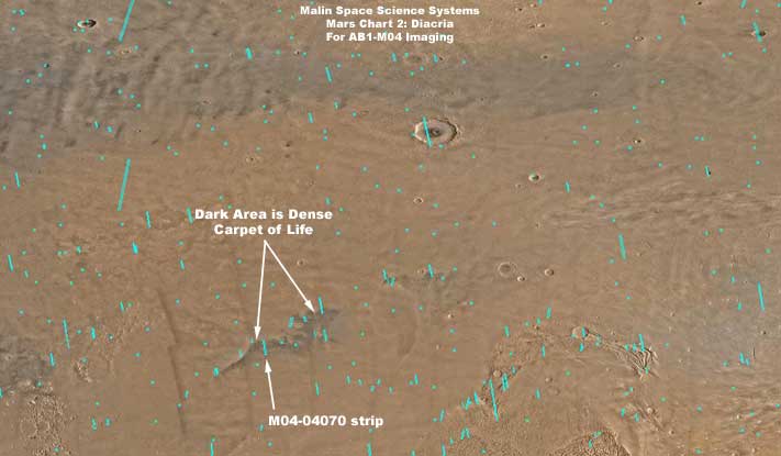
M04-04070 via MARS CHART #2... (http://www.msss.com/moc_gallery/ab1_m04/mc02.html) ... This URL links you to the M04-04070 discovery evidence via a MSSS graphical browser interface in the form of the Mars Chart 02: Diacria imaged above. This image also gives you a look at the wide region and dark area from which the life evidence here was drawn and you can see the dark tinted fracture zones at the west (left) end.
MO4-04070 at MSSS ... (http://www.msss.com/moc_gallery/ab1_m04/images/M0404070.html) ... This URL links you directly to the official science data strip at Malin Space Science System (MSSS). Remember the caution that the third listed GIF strip has been flipped at official level and, if you use this strip, it will have to be flipped back to the correct orientation.
M04-04070 at USGS ... (http://ida.wr.usgs.gov/html/m04040/m0404070.html) ... This URL links you directly to the official science data strip at the United States Geological Survey (USGS). Remember that this image has been flipped at official level, which negatively impacts this evidence, and the strip will have to be flipped back to the correct orientation as confirmed in the MSSS context image below.
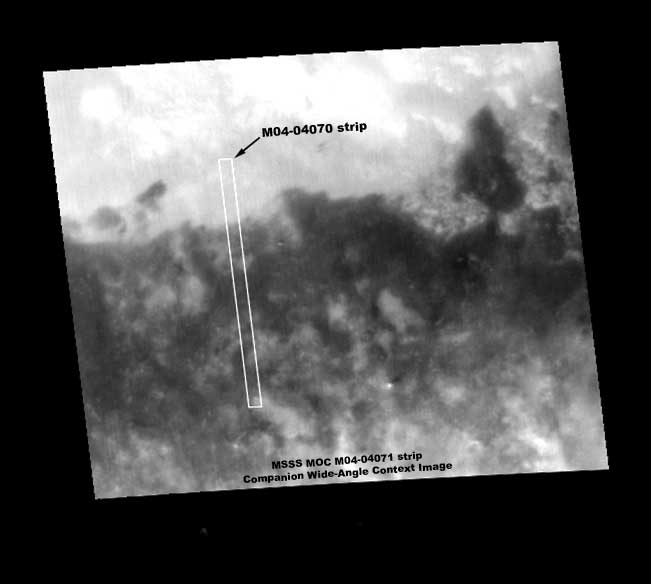
The above MSSS context image confirms the correct M04-04070 strip orientation. It also shows us that there is a relatively clear demarcation between the dark area life boundary and the light color surrounding terrain.
Researchers should also be aware that the context images at the PDS and USGS official sites show the M04-04070 narrow-angle strip as fully embedded in the large dark area. This is perhaps because they are using 20+ year old Viking image data as context imaging. However, the M04-04070 strip itself and the above newer and clearer MSSS companion MOC M04-04071 wide-angle context image clearly demonstrates that this long narrow-angle strip crosses the boundary between the dark area and the very light color and highly reflective surrounding terrain. This is a discrepancy that may or may not have significance.
It is possible that 20+ years have passed and the dark area boundary edges are shrinking inward because the life evidence is struggling to survive. However, it is also possible that the highly reflective odd and strange outer terrain look has been artificially applied via a filter and the obscuring high reflectivity application in the newer MOC data didn't just exactly match the boundary lines in the similar application in the older Viking data.
I do not know the answer to this and don't have time to pursue it. I'm just bringing the discrepancy and possible quick explanations to your attention. Always remember that caution is called for when viewing this science data simply because, whether admitted to or not, it is obviously subject to National Security secrecy considerations, influences, and manipulations.
, Investigator
![]()